
HARVEY MAPS has launched its latest addition to its ever-popular Trail Map series with 2 new titles to cover the challenging Welsh mountain trail, the Cambrian Way.
Known as the “mountain connoisseur’s walk”, the Cambrian Way runs from Cardiff Castle in the south of Wales, to Conwy Castle in the north, and takes in both Bannau Brycheiniog (Brecon Beacons) and Eryri (Snowdonia) National Parks.
The entire route takes approximately 3 weeks to walk and is typically walked from south to north. The terrain is often rough and hard-going and daily stages require careful planning. The 24,000 metres of ascent are not to be taken lightly!
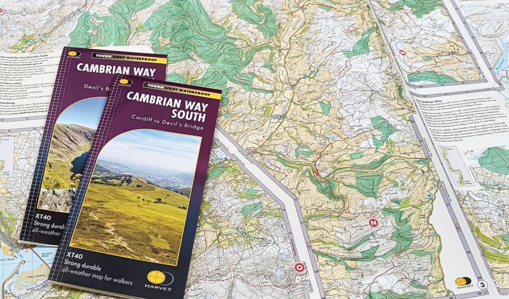
These new maps have been produced using a combination of traditional map-making techniques with cutting-edge technology and the two waterproof maps will be an invaluable resource for adventurers looking to take on the challenge of the Cambrian Way. The route is 479km long and goes over many of Wales’ major mountains, offering some of the country’s finest scenery along the way.
The maps have been produced with advice and assistance from the Cambrian Way Trust.

Richard Tyler, chairman of the Trust, said: “High navigation skills are needed for this walk which is why HARVEY maps are so valuable.
“Much of the route is through open country where often there are no paths and in some of the most difficult country satnav is not available.
“To quote Tony Drake, creator of the Cambrian Way route, maps are absolutely essential for navigation on the Cambrian Way.”
HARVEY Maps has produced two intricately designed maps, combining accuracy with stunning visual representation. Each map is laid out in panels at the popular 1:40,000 scale and in total the two maps weigh just 100g!
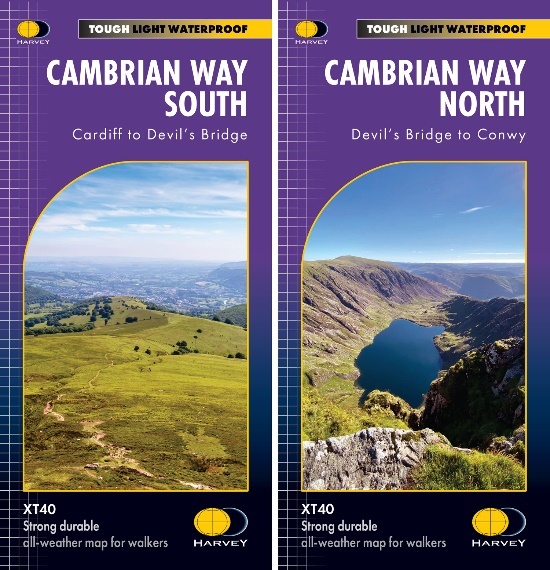
The Cambrian Way South (Cardiff to Devil’s Bridge) and Cambrian Way North (Devil’s Bridge to Conwy) maps are out now and are priced at £17.50 each. They are available from www.harveymaps.co.uk
Key features:
- Entire route on just two maps: the whole of the Cambrian Way is shown on two double-sided sheets, which means the user only carries 100g of mapping instead of a stack of sheet maps!
- Comprehensive route information: the route of the Cambrian Way (shown in red) is well categorised and easily visible against the detailed base mapping.
- Detailed Topography: HARVEY Maps’ unrivalled attention to detail ensures all geographical features, including mountains, valleys, rivers, lakes, walls and paths are accurately represented in a clear and uncluttered way. Facilities are also clearly marked to help the user along the way.
- Original mapping: The mapping is created in house by HARVEY Maps’ team of highly skilled photogrammetrists and cartographers. The route is then surveyed on foot to capture any final changes to the base mapping before the final maps are printed and published.
- GPS compatible grid: the maps use the National Grid, allowing users to seamlessly integrate modern navigation tools with traditional map reading techniques for a more enhanced adventure experience.
- Waterproof: each HARVEY map is 100% waterproof.