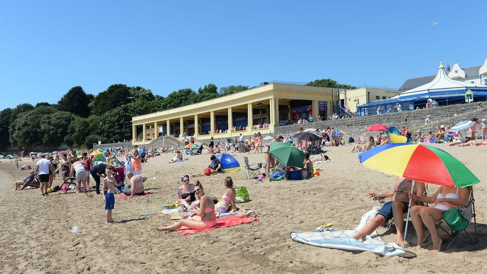
AS we approach the start of meteorological summer this weekend, there’s finally some promising weather news. Forecasters predict that high pressure will build over the weekend, bringing warmer and drier conditions.
The Met Office has issued its latest three-month UK outlook, forecasting a “warmer than average summer is likely.” However, Welsh weather forecaster Derek Brockway cautions that this doesn’t necessarily mean heatwaves, although he notes that the “risk is higher than normal.” He also mentions: “Rainfall is more uncertain. August is often the wettest summer month in Wales, but in 2022 it was the driest!”
This week, after a mix of thunderstorms, heavy rain, and sunshine, the hope is that high pressure will bring more settled conditions by the weekend.
Derek says: “Drier, more settled weather is on the way for the start of June and meteorological summer this weekend, thanks to high pressure. Expect some patchy clouds and sunshine, and it will feel warmer with lighter winds.”
The Met Office forecast for the UK indicates a reduction in rainfall on Friday for most areas, although there remains a chance of some showers in the southeast. They add: “It’ll be the start of a period of dry and fine weather for many as a ridge of high pressure builds from the west.”

The forecast for Wales this weekend states: “Any isolated showers will clear through the morning on Friday, leaving a dry day with a mixture of cloudy periods and sunny spells. It will still be breezy with a maximum temperature of 19°C. High pressure will bring dry and settled weather this weekend, lasting into next week. Expect periods of warm sunshine with occasional cloudier spells. Temperatures will be close to average with light winds.”
Deputy Chief Meteorologist Helen Caughey said: “From Friday, we see a change in weather type, with conditions turning drier and more settled from the west. Although some showers are possible at times – most likely in the southeast initially and later in the weekend in the northwest – many should see a decent amount of sunshine. With the exception of the southeast at first, where it will be rather cool to start the weekend, temperatures are generally unremarkable for the time of year, close to or a little above average. However, it will feel a little warmer with light winds and prolonged sunny spells, generally away from windward coasts.”
Looking further ahead, the Met Office expects high pressure to remain dominant on Monday, bringing spells of warm sunshine and light winds to much of the UK, though some patchy rain and drizzle may arrive in the northwest.
The less favourable news is that more unsettled conditions are likely to return later next week, although the timings remain uncertain at this range.
The UK long-range forecast for Monday, June 3, to Wednesday, June 12, states: “In early June, conditions are likely to be generally settled due to the influence of high pressure extending across much of the country. A few showers or patchy rain are possible in places, most likely in the northwest, but for most, it will be dry at the start of the period with plenty of sunshine, especially in the southeast. It will feel warm generally, though cooler near the coast where onshore breezes develop.”
It continues: “This fair weather is likely to continue for a few days into the following week, but thereafter the outlook becomes more uncertain. The south of the UK will probably be drier, although scattered showers are possible at times. Cooler and cloudier conditions are expected further northwest, where rain is more likely. Temperatures will probably be around normal or a little above average.”